Highway 99
Will I have a 99 day today?
A live dashboard for the Sea to Sky Highway. Drive times, highway cameras, DriveBC warnings and reports from other drivers, from Vancouver to Pemberton, on one map.
- Year
- 2026
- Type
- Web app
- Built with
- React, TypeScript, Mapbox
- Status
- Live
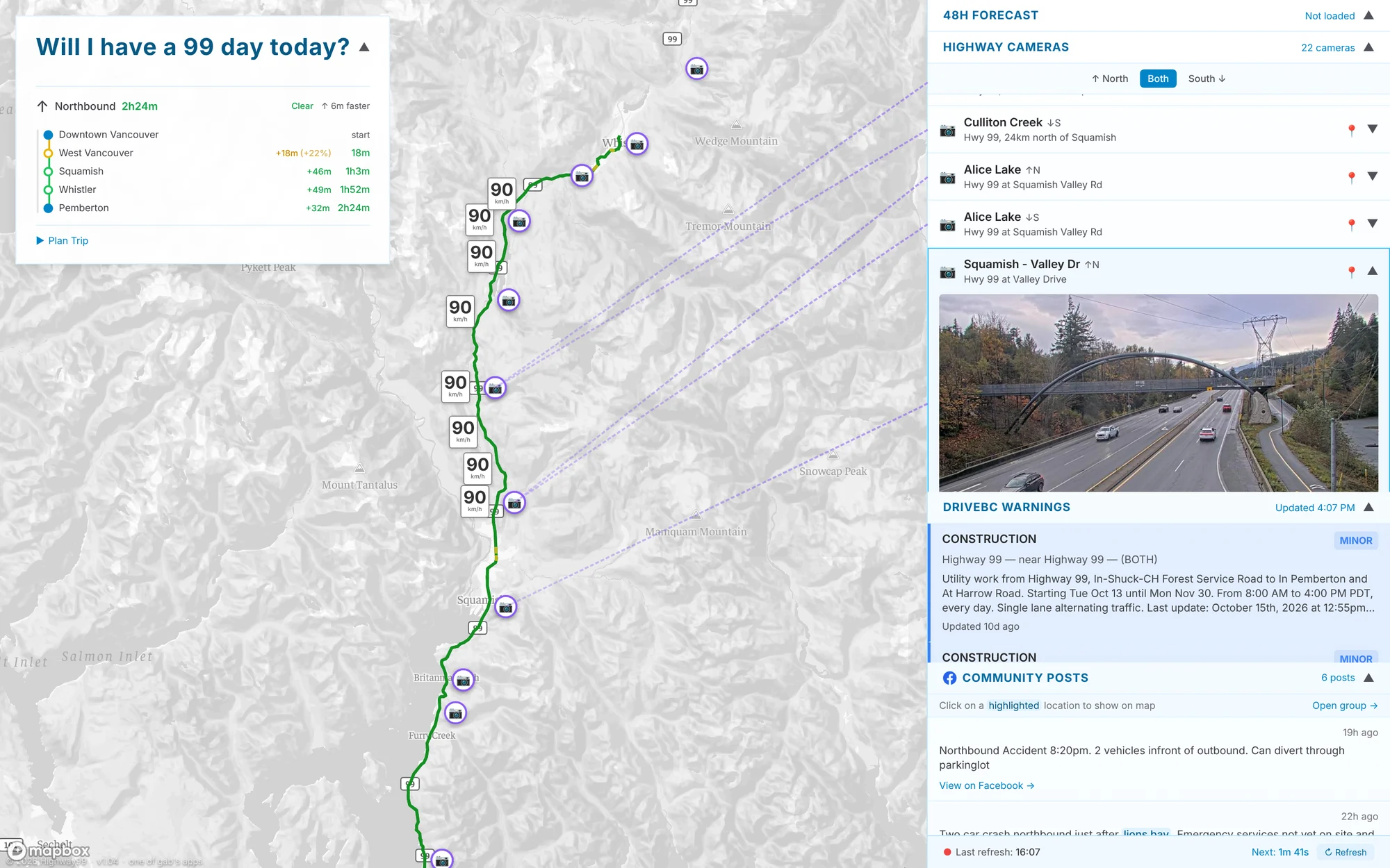
One road, everything about it
Highway 99 is the only road between Vancouver, Squamish, Whistler and Pemberton. When it’s clear, it’s one of the best drives anywhere; when there’s a crash, a closure or snow, there’s no other way around. Finding out before you leave means checking DriveBC, the cameras, the weather and a Facebook group of locals, one tab at a time.
Highway 99 puts all of that on one map of the corridor. Every source refreshes every two minutes, so a glance tells you whether today is a good day to go, and when.
Know before you’re in the lineup
-
Where the delay is, not just how long
Live drive times for each leg, from Downtown Vancouver to Pemberton, each compared with a normal day, so you can see which stretch is slow and which direction is faster.
-
Plan around it
Pick where you’re starting and where you’re going, then choose a time to depart or a time to arrive, and get the other end worked out from current traffic.
-
See it for yourself
Twenty-two highway cameras are pinned to the map and listed by direction, along with the speeds currently posted on DriveBC’s variable speed signs.
-
Hear it from other drivers
DriveBC’s official events sit next to posts from the Sea to Sky road conditions group. Places named in a post are picked out and can be shown on the map.
A glance before you go
-
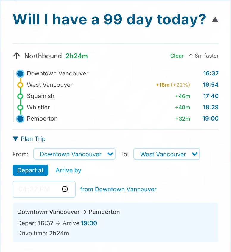
01
Check the drive
Drive times come from live traffic, leg by leg and colour-coded by how much slower than usual each one is. Flip between northbound and southbound, or open the planner for an arrival time.
-
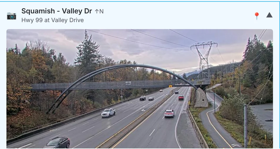
02
Look at the road
Tap a camera on the map or in the list to see the latest image, from Lions Bay to Pemberton. A dotted line ties each one back to where it sits on the highway.
-
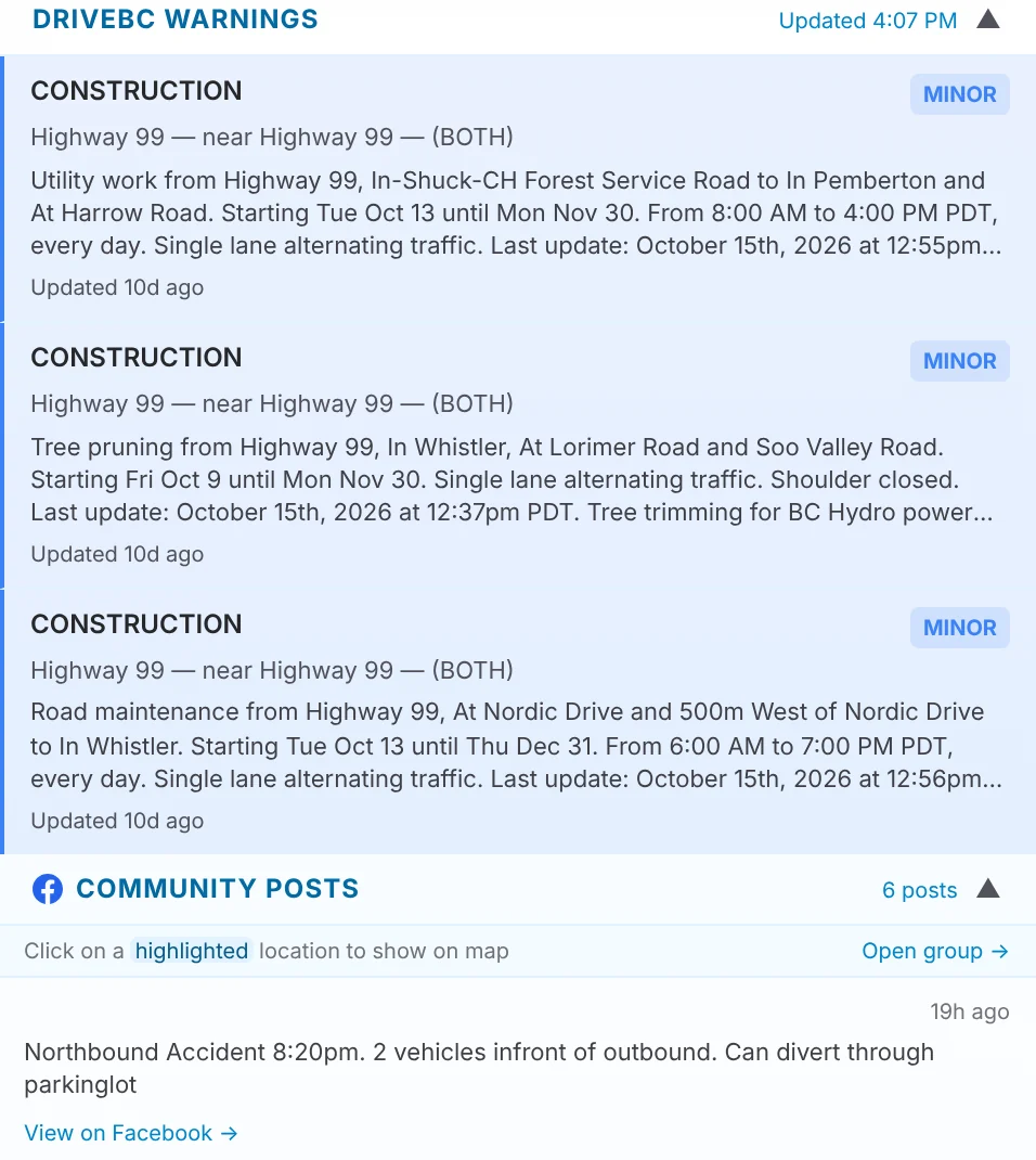
03
Read what’s going on
Construction, closures and incidents from DriveBC, marked by severity, then what drivers are reporting right now: a crash just past Lions Bay, a bear cub heading for the road.
How it’s built
- Front end
- React, TypeScript and Vite, with React Query and Zustand
- Map
- Mapbox GL with a custom live-traffic style, camera and speed-sign markers, and animated wind from Open-Meteo
- Data
- DriveBC’s Open511 events and variable speed signs, highway cameras, Environment Canada weather warnings, Open-Meteo forecasts and Mapbox traffic-aware driving times
- API
- One Express function on Vercel that caches each source for a few minutes