Airplan
Will I get in trouble for flying today?
An airspace map for pilots. Click anywhere and Airplan shows every layer of controlled and restricted airspace above that spot, from the ground up.
- Year
- 2026
- Type
- Web app
- Built with
- Next.js, Leaflet, Three.js
- Status
- Live
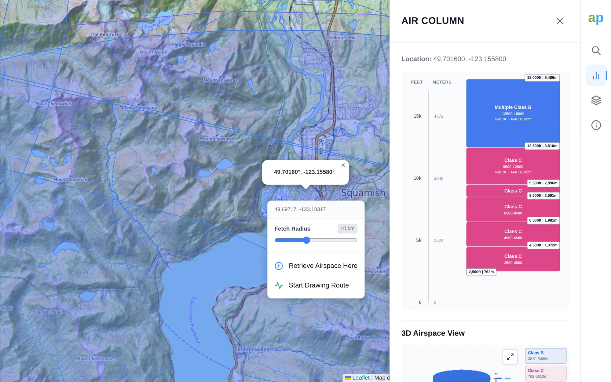
Airspace you can actually read
Aeronautical charts pack airspace into flat lines and symbols, and the layers stack: a Class C shelf might begin 2,500 feet up, with another above it and another above that. For a paraglider or drone pilot the real question is simpler. Can I fly here, and how high?
Airplan draws Canada’s airspace on a topographic map. Click a point and it lists every layer above it, with floors and ceilings in feet and metres, then shows the whole stack in 3D.
The answer, not the chart
-
One click, the whole column
No decoding symbols or cross-referencing supplements. Tap the map and every layer above that point is listed in order.
-
Feet and metres side by side
Airspace is defined in feet; free-flight pilots and drone operators often think in metres. Airplan labels every boundary in both.
-
Terrain in the picture
The topographic base map puts airspace floors next to the mountains, which matters when launch is already 1,500 m up.
-
Made for free flight
Thermal overlays for soaring pilots, and Liftseeker links straight to the airspace above each launch.
From a click to a flight plan
-
01
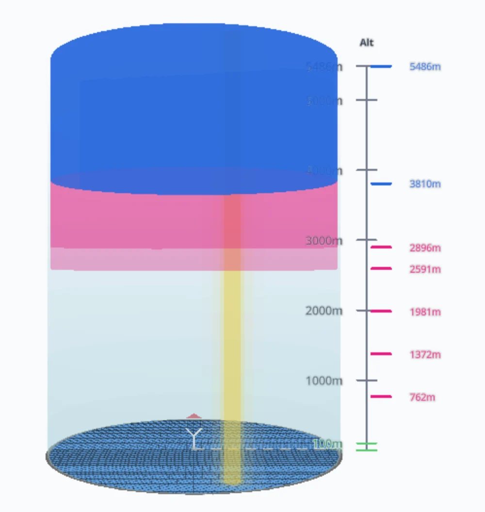
See the stack in 3D
Each layer becomes a coloured cylinder at its real floor and ceiling, so it’s obvious where the gaps are and how much room you have underneath.
-
02
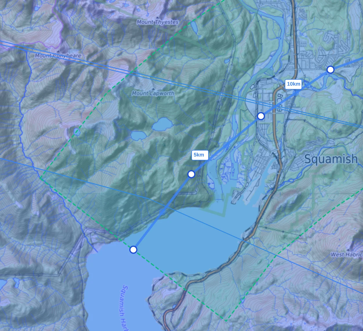
Plan a route
Draw a route, or import a GPX or KML track, and Airplan checks the airspace and terrain along a corridor on either side of it, with distance markers as you go.
-
03
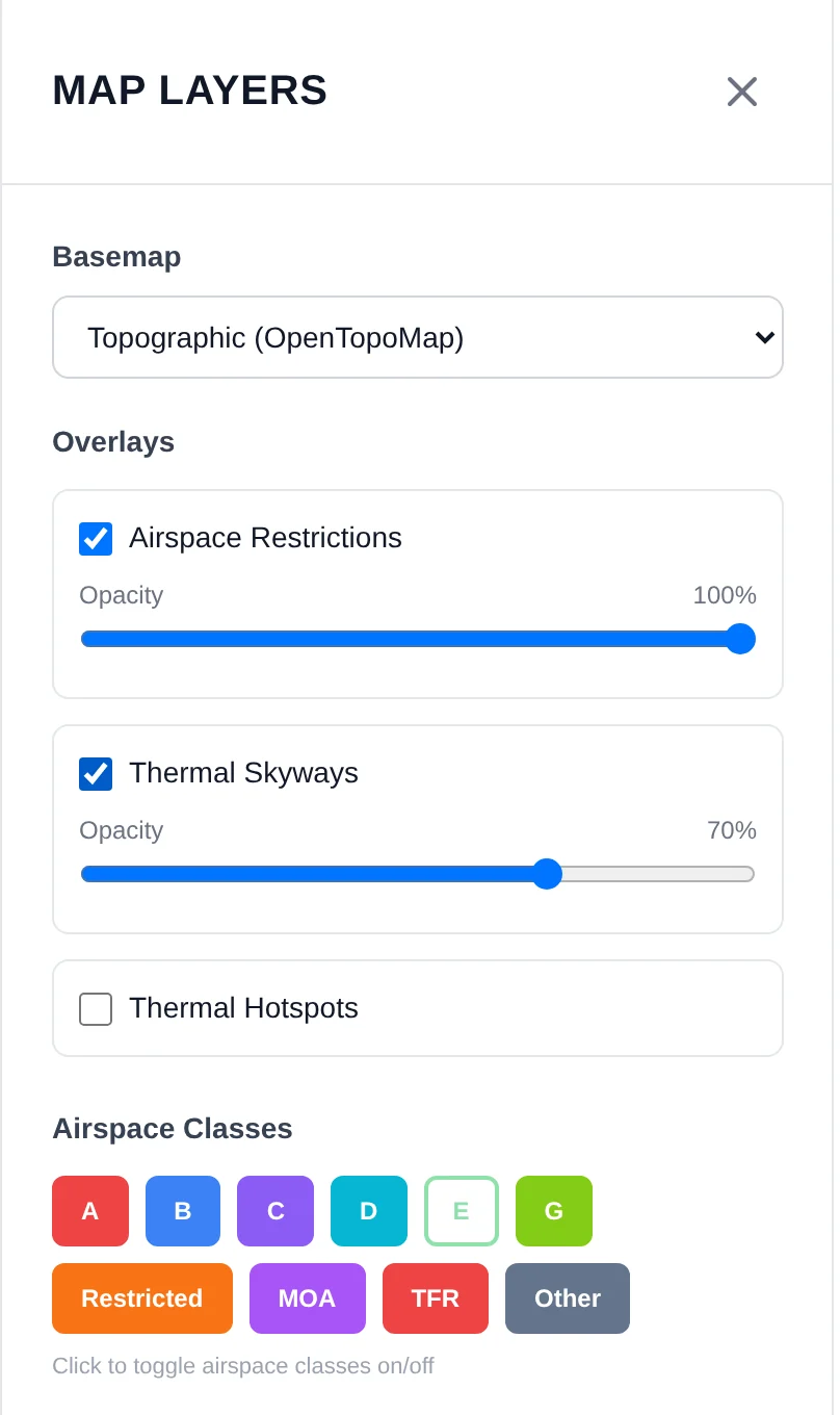
Show only what matters
Pick from fifteen base maps, add thermal overlays, and hide the airspace classes or altitude bands that don’t apply to how you fly.
How it’s built
- Map
- Leaflet, on OpenTopoMap by default
- 3D
- Three.js through React Three Fiber
- Airspace
- OpenAir definitions parsed into polygons, with a point-in-polygon lookup for every click
- Framework
- Next.js, hosted on Vercel